- Products
- Who is it for?
-
Our clients
They trust us
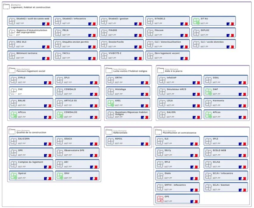
Local governments, universities, manufacturers… Over 200 organizations trust us
User ClubAn active community focused on enterprise resource planning (ERP) mapping
Customer testimonialsConcrete projects and feedback from the field
Customer portalAccess your dedicated resources and services
Headlines Read the customer testimonial
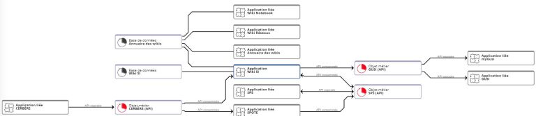
Find out how Bouygues Construction manages 1,500 applications and is accelerating the modernization of its IT system with myCarto.
-
Guides & news
Articles & guides
Practical Tips for Managing and Optimizing Your IT System
Events & webinarsWebinars, demos, and live customer testimonials
FAQWe answer your most frequently asked questions!
Headlines Read the article
ANSSI Roadmap: Recommendations and Best Practices for Effective Cybersecurity
- About